Courses taking place from June 3 to 5, 2025 in São Paulo, Brazil, will offer the opportunity to deepen knowledge, learn about industry innovations and develop essential skills. Registration with 40% discount only until January 31!
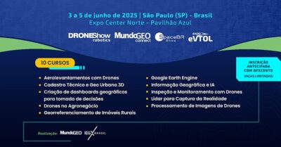
 Early registrations are now open with discounts for the 10 courses at MundoGEO Connect and DroneShow Robotics 2025, which will be held in parallel with SpaceBR Show and Expo eVTOL, from June 3 to 5 at Expo Center Norte – Pavilhão Azul, in São Paulo (SP), Brazil.
The courses offered at the event are focused on providing comprehensive training in the areas of geospatial technology and drones. They cover topics such as digital mapping, geographic information systems (GIS), remote sensing technologies and drone applications. Taught by recognized experts in the market, the courses offer participants the opportunity to deepen their knowledge, learn about the latest innovations in the sector and develop essential skills for their professional careers.

10 courses
Check out the 10 courses that will take place at MundoGEO Connect and DroneShow Robotics 2025:
-
- Aerial Surveys with Drones
-
- Geographic Dashboards for Decision-Making
-
- Technical Catastre and Urban Geo 3D
-
- Drones in Agriculture and Forestry
-
- Georeferencing of Rural Properties
-
- Google Earth Engine
-
- Geographic Information and AI
-
- Inspections and Monitoring with Drones
-
- Lidar for Reality Capture
-
- Drone Image Processing
June 3
Course: Technical Catastre and Urban Geo 3D
The course covers concepts of Technical Catastre, applicable legislation, Cartographic Survey Methodologies (Drone x Conventional), available technologies, Municipal Cadastral Reference Network, Digital Twins and Sinter – National system for managing territorial information. Instructor: Givanildo Silva (Topocart).
Course: Rural Property Georeferencing
The value of a professional is currently directly linked to what he or she “delivers” to his or her client: the owner of the rural property. A job ends when the property is regularized. The “Territorial Manager” is the professional who does not only certify the property or the CCIR, CAR, etc., but rather the one who understands that the property is only duly regularized in environmental, tax and land aspects. There are several paths: Rectification, Certification, Usucapion, Compulsory Adjudication, Extremization, etc. This is what we will cover in this course. Instructor: Margaret Maria (TGR Treinamentos).
Course: Dynamic Geographic Dashboards for Decision-Making
This course will demonstrate how the use of geographic dashboards supports various sectors through the integration of geographic databases and innovative GIS applications. Instructor: Sandro Laudares – Researcher, PhD in Geography, Professor at PUC Minas and Postgraduate Instructor at GEOeduc.
Course: Drone Image Processing
This course aims to present concepts and applications on digital image processing for generating information in maps and 3D models. The use of software for generating geographic data in point cloud, TIN, raster and contour lines structures will be covered. Instructor: George Longhitano (G Drones).
June 4
Course: Aerial Surveys with Drones
The course will cover the basic concepts of aerial photogrammetry with drones (capture, processing and products) and how they are applied. Some models of drones and sensors available on the market will be discussed. In the operational part, the course will cover everything, from planning an aerial survey, the execution phase, data processing and analysis of the materials obtained. There will also be a brief discussion on regulations. Instructor: Wanderley Kampa Ribas (Geoazimute).
Course: Inspections and Monitoring with Drones
The course details data collection techniques using drones, processing using artificial intelligence, legislation and presents some case studies. Recommended for professionals who work with inspection and asset monitoring activities for different applications, with the objective of obtaining productivity gains in data collection in the field and data analysis. Instructor: Emílio Hoffmann (H3 Dynamics).
Course: Geographic Information and AI
Course focused on acquiring knowledge of artificial intelligence, machine learning, deep learning and computer vision applied to geospatial technologies, through the Python programming language. Materials will be made available in PDF, shapefiles, raster files and codes used during the course to assist students in preparing the proposed activities. Instructor: João Otávio Nascimento Firigato (AmbGEO).
June 5
Course: Drones in Agriculture and Forestry
The course presents applications of drones in agriculture and forestry, in data generation. The uses in mapping and identifying problems in crops will be covered, as well as in aerial applications and spraying by drones. Instructor: George Longhitano (G Drones).
Course: Lidar – State-of-the-art in Reality Capture
In this course, we will address the concept and use of Aerial (UAV), Terrestrial and Mobile Lidar in topographic survey activities, as-built installations and reality capture, in general, as support for projects. The objective is to inform and provide support so that students are able to understand the technology, have notions of applicability and learn about the most diverse types of equipment and platforms available. Instructor: Boaz Teixeira (Consultant specializing in Lidar).
Course: Google Earth Engine
This course is aimed at acquiring knowledge in satellite image processing through the Google Earth Engine tool, using the JavaScript programming language. Materials in PDF format, shapefiles, and codes used during the course will be made available to help students prepare the proposed activities. Instructor: Christhian Santana Cunha (AmbGEO).
Register in advance with a discount. Limited places!
Course registration includes:
-
- Access to the activity(ies) purchased;
-
- Access to the content (slides) of the course(s) purchased – post-event;
-
- Certificate of participation, upon proof of attendance.
Benefits for those registered for the activities and visitors to the exhibition:
-
- Access to the 3 days of the trade fair;
-
- Digital certificate of participation in the exhibition;
-
- Free access to the Free Activities.
Products and services exhibition
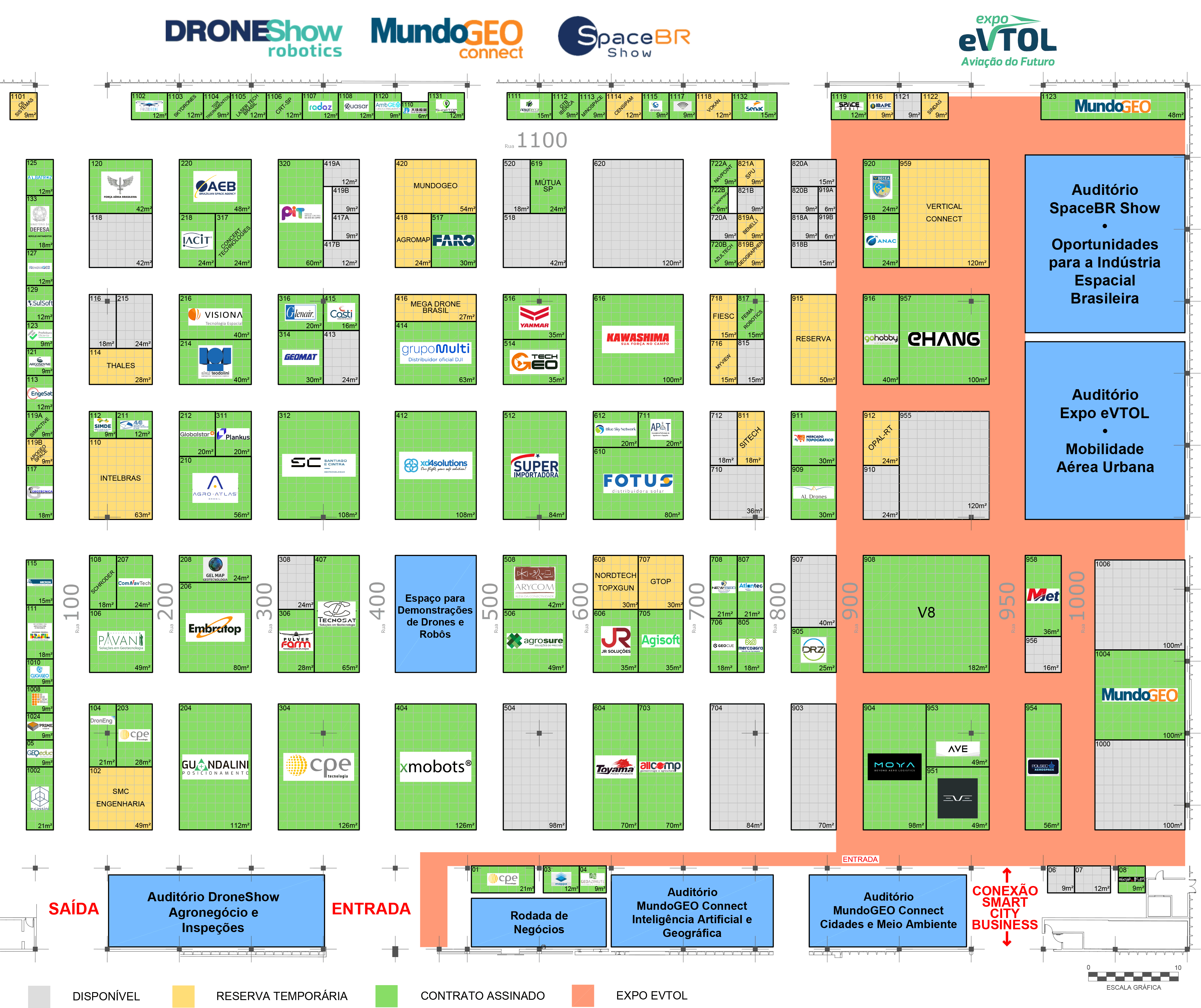
In addition to the courses and seminars at MundoGEO Connect and DroneShow Robotics, there will also be an exhibition for products and services featuring the entire production chain of the geospatial technology and drone sector. See who has already confirmed or reserved their place at the 2025 exhibition:

Check out the full list of exhibitors
Business Roundtable
At the Business Roundtable that will take place at the trade fair, exhibiting companies in the sector will have the opportunity to participate in pre-scheduled 20-minute meetings, according to the demand and supply of interested parties, increasing the possibility of generating qualified leads and opportunities for partnerships and business in the geospatial technology, drone, space and advanced air mobility markets.

Simultaneous events
Simultaneously to MundoGEO Connect and DroneShow Robotics 2025, two other technology events will be held at the same location: SpaceBR Show, for the space sector; and Expo eVTOL, for the Aviation of the Future. The Smart City Business Brasil, dedicated to smart cities, will be held in the pavilion next door.
Follow the event’s progress, the floor plan and the schedule of activities on the websites:
Highlights from the last edition
The MundoGEO Connect, DroneShow Robotics, SpaceBR Show and Expo eVTOL 2024 exhibitions exceeded expectations and brought together 8,100 professionals from 33 countries over three days, a 42% increase over the previous edition. Organized by MundoGEO, a company recently acquired by the Italian Exhibition Group (IEG), the events took place from May 21 to 23, 2024 at the Expo Center Norte – Pavilhão Amarelo, in São Paulo (SP), Brazil, and established themselves as the largest meeting in the Americas that brings together the sectors of geographic intelligence, drones, space and eVTOL aircraft in the same space.
The exhibition area, which grew 50% in size compared to 2023, brought together 120 exhibitors representing more than 200 brands, with emphasis on national and international players. In addition, the program, which included 25 activities covering courses, seminars and forums, featured 180 speakers from various countries, enabling the sharing of knowledge and experiences in these markets.
Check out the highlights of the latest edition of the exhibition:
About MundoGEO
MundoGEO, founded in 1998, aims to promote connections, innovations and generate business in the sectors of drones, eVTOLs, autonomous mobile robotics, space and geospatial technologies. To this end, we generate content through the Web Portal www.mundogeo.com and organize online events and the in-person exhibitions MundoGEO Connect, DroneShow, SpaceBR Show and Expo eVTOL.
In July 2023, MundoGEO was acquired by the Italian Exhibition Group (IEG). Listed on the Milan Stock Exchange, IEG is one of the leading companies organizing exhibitions and congresses in Europe. In recent years, it has begun to expand its operations to Brazil, China, the United States, the United Arab Emirates and Mexico. For more information: www.iegexpo.it.


