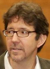
 Mr. Eric van Praag currently coordinates the GeoSUR Program at CAF-The Latin American Development Bank. Before joining CAF in 2006 he worked for the U.S. Geological Survey for 7 years and for the United Nations Environment Program for 2 years He has done consulting work for several international organizations, including UNDP, WRI, the World Bank, the OAS, and WCMC.
Abstract: The GeoSUR Program seeks to make geographic information useful for policy makers seeking to find practical answers to problems bridging borders and disciplines. GeoSUR implements an effective inter-institutional mechanism for generating, disseminating, and exploiting geospatial data useful for decision-making and policy support in Latin America and the Caribbean (LAC). The Program has developed five main components: i) a Regional Geoportal, ii) a decentralized network of map services, iii) a LAC regional Map Service, iv) a Topographic Processing Service, and v) focused regional geoprocessing tools for energy assessment and disaster early warning. More tan 90 agencies from 25 Latin American countries actively participate in GeoSUR.
Eric van Praag will be speaker at MegaTrends Seminar, to be held in June 18th as part of MundoGEO#Connect LatinAmerica 2013, Conference and Trade Fair on Geomatics and Geospatial Solutions, in Sao Paulo, Brazil.
 Português


