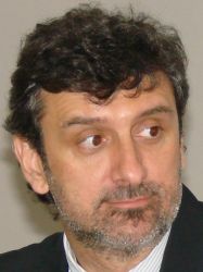
 Land Surveyor by National University of Rosario, Argentina. Post-Doctorate in GIS at the University of Shiga in Japan, and at the Clark University in the IDRISI Project. Since 2004 he is Fellow in the Program for Latin America and the Caribbean by the Lincoln Institute of Land Policy which manages the area of distance education and conducts research and publications on topics related to territorial cadastre and GIS. Currently a member of the Working Group on 3D Cadastre Commission 7 of the International Federation of Surveyors – FIG, and consultant for the Millenium Challenge Corporation on the project “Cadastre and Land Tenure” in Cape Verde.
Abstract: Cadastral maps and databases are the most detailed sources of territorial information because they are focused on the most basic cell of any jurisdiction: the parcel. Well-structured cadastres are essential for urban geographic studies and they definitively must be a component of a Spatial Data Structure – SDI at any jurisdiction level, because it is the materialization of a Multipurpose Territorial Cadastre – MTC. Since during the last decade the cadastres are changing their view point from 2D to 3D, it is necessary to review their perspective and the consequences on the SDI. For proper 3D object management, it is essential to work with software-based GIS and databases that are capable of managing 3D objects. The term “3D object management” does not mean drawing or visualizing elements in three dimensions, but rather being able to store objects having 3D properties and topology, edit in 3D, apply 3D symbology; and even perform an analysis in 3D. In Latin America in particular, formal and informal spaces cities are gradually being constructed in virtual 3D environments. There are several, but atomized, initiatives which could be capitalized into a full 3D cadastre in different jurisdictions. Their description and correlation through publications and conferences will contribute to disseminate the spatial ideas and will open new opportunities for 3D cadastre implementations.
Diego Alfonso Erba will be speaker at MegaTrends Seminar, to be held in June 18th as part of MundoGEO#Connect LatinAmerica 2013, Conference and Trade Fair on Geomatics and Geospatial Solutions, in Sao Paulo, Brazil.
 Português


