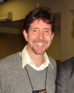
 Mr. Eric van Praag currently coordinates the GeoSUR Program, a Latin American Spatial Data Infrastructure Initiative led by CAF – The Latin American Development Bank and the Pan-American Institute of Geography and History (PAIGH). GeoSUR has established the first Latin American Network of geospatial data providers, in support of better project planning and decision making in the region. Mr. van Praag also serves as the Information Technology Officer in charge of designing and implementing ICT for development projects in the Latin America region on behalf of CAF. He is the South American representative and the Chair of the Technical Committee of the Global Spatial Data Infrastructure Association and a member of the Open Geospatial Consortium (OGC) Global Advisory Board.
Mr. van Praag obtained his bachelor degree in Computer Sciences from Universidad Simón Bolívar (Venezuela) in 1986 and his M.Sc. degree in Environmental Sciences from Salford University (UK) in 1991. Before joining CAF in 2006 he worked for the U.S. Geological Survey for 7 years, coordinating the development of geospatial projects in Latin America and for the United Nations Environment Program – Caribbean Environment Programme for 2 years in the establishment of a Caribbean Environmental Data Network. He has done consulting work for several national and international organizations, including the United Nations Development Programme (UNDP), the World Resources Institute (WRI), the World Bank, the Organization of American States (OAS) the World Conservation Monitoring Center (WCMC) and several Venezuelan institutions.
Eric van Praag will be speaker at Seminário Gestores Públicos de Geoinformação,to be held in may 7th as part of MundoGEO#Connect LatinAmerica 2014, Conference and Trade Fair on Geomatics and Geospatial Solutions, in Sao Paulo, Brazil.
 Português


