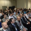
MundoGEO#Connect LatinAmerica 2012, the largest event in geospatial industry in Latin America, held from May 29 thru 31 at the Frei Caneca Convention Center, in Sao Paulo (SP), Brazil, will feature a seminar on applications of satellite images in areas such as environment, energy, oil & gas, agriculture and infrastructure.
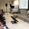
In addition to that, during the Seminário Imagens de Satélite, which takes place on May 31st as part of the schedule of MundoGEO#Connect, we will introduce the main characteristics of each type of image, separated into optical, radar or laser. The presentations begin at 9 am, with the “Panorama sobre os principais satélites e sensores” panel, in which Antonio Machado, director of AMS Kepler, will explain the orbital sensors currently available, as well as new satellite for the coming years.
Right after this lecture, there will be a presentation on the use of satellite images for projects in the areas of environment, energy and mining. Representatives of Greenpeace, Itaipu and Geological Survey of Brazil will be present.
The agribusiness sector will also have an exclusive panel in this seminar. At 2pm, we’ll proceed with a debate on the challenges and results of applications of orbital sensors in agriculture and forests’ areas. Bernardo Rudorff, from the Instituto Nacional de Pesquisas Espaciais (INPE), and Edson Luis Bolfe, from Embrapa Monitoramento por Satélite, will be among the speakers.
To sum up, there will be a presentation on the use of satellite images in planning, execution and monitoring projects and minimizing interventions in the environment, with confirmed presence of Wilson Holler, of Embrapa, and Ronan Max Prochnow from Eletrobras Eletrosul.
“This seminar is a unique opportunity to learn several aspects of remote sensing in a single day,” said Eduardo Freitas, technical coordinator of MundoGEO#Connect Latin America 2012. “Participants will be in touch with some of the most experts on satellite images in Brazil and will be able to interact with the presenters in the sessions of questions and answers. Furthermore, the intermissions will also be great opportunities to know the fair of products and services of the event, which will present the main providers of satellite images”, he concludes.
Event
Satellite Images Seminar
Date: May 31, from 9am to 5:45pm
More Information: https://mundogeoconnect.com/2012/grade/seminario-imagens-de-satelite/
FAQs
> How did the event start? MundoGEO#Connect LatinAmerica came about from the perception of its founders on issues that resonate the most in the major social networks, in surveys with magazine subscribers and visitors to the MundoGEO portal. Thus, one objective of the event is to connect, either in person or online, users, experts and decision makers in the area of geo, so there is an exchange of ideas on current issues of the geospatial industry in Brazil and Latin America.
> How is the workspace? The number of auditoriums for the activities of MundoGEO#Connect LatinAmerica 2012 was enlarged by 100% in relation to the 2011 event. Also, in this edition, the venues at the products expo and services were increased by 50%. Free access to the expo is granted for users and industry professionals.
> Who attends the MundoGEO#Connect LatinAmerica? The data collected in the 2011 edition showed that 32% of the participants are directors and 33% managers or coordinators, 50% are from the private sector and 36% in the public sector and the areas with higher percentages of interest are the environment, natural resources, utilities, infrastructure and land planning.
> How was the first edition of the event? In 2011, there were more than 100 speakers, including representatives of international companies such as Joel Campbell, the president of Erdas, Tarun Bhatnagar, director of corporate geo of Google for Latin America; Wolfgang Bidermann, executive of RapidEye; Dale Lutz, vice president of product development at Safe Software, and Mike Renslow, representative of the International Society for Photogrammetry and Remote Sensing (ISPRS).
> What’s new in MundoGEO#Connect LatinAmerica 2012? According to Emerson Granemann, director and publisher of MundoGEO Group, the event will have several seminars, workshops and side events that will discuss trends in GIS, remote sensing, land surveying, GPS and spatial data infrastructures in the areas of oil & gas, mining, government, agribusiness, environment, among others. “We have a lot of innovations in this second edition. The award ceremony was expanded to choose the best professionals, institutions, companies and brands, upon voting on the Internet throughout the geo community”, says Emerson.
> How can I participate? Registrations for the event are already open. If you would like to participate of MundoGEO#Connect LatinAmerica 2012, send an e-mail to connect@mundogeo.com.
MundoGEO#Connect LatinAmerica 2012 has the following companies as strategic partners:
> Erdas
> RapidEye
> Leica Geosystems
> Intergraph
> Trimble
> Google
> DigitalGlobe
> GeoEye
> Geomax
> Topcon
> TomTom
MundoGEO#Connect LatinAmerica 2012 is supported by the Instituto Brasileiro de Geografia e Estatística (IBGE), Embrapa Monitoramento por Satélite, Empresa Paulista de Planejamento Metropolitano (Emplasa), Prefeitura de São Paulo, Serviço Geológico Brasileiro (CPRM), Diretoria de Serviço Geográfico do Exército (DSG) and Comitê Permanente para a Infraestrutura de Dados Geoespaciais das Américas (CP-IDEA) as well as international support of Open Geospatial Consortium (OGC), the International Society for Photogrammetry and Remote Sensing (ISPRS) and the Association of Technology and Geospatial Information (Gita).
About MundoGEO#Connect LatinAmerica 2012
MundoGEO#Connect LatinAmerica 2012 is the largest annual event in the area of geomatics and geospatial solutions and will take place between May 29 and 31 at the Frei Caneca Convention Center in Sao Paulo (SP). With the theme “Sharing information for a better world”, the expectation is to bring together 10,000 people in the field, between participants in the seminars, forums and courses, the expo visitors and people connected via webinar and social networks. The event is a creation of MundoGEO, with the support from IBGE, Emplasa, Sao Paulo City Hall, Embrapa Satellite Monitoring, Ministry of Defense of Geographical Service, among others. The event features several courses, seminars and forums, plus a marketplace with more than 70 global brands such as Google, Trimble, Hexagon, Erdas, DigitalGlobe, Leica, RapidEye, Astrium, GeoMax, Topcon, among others. Internationally, the event has the support of OGC, ISPRS, GITA, Directions Magazine, GIM International, V1 Magazine, Professional Surveyor and Geo Connexion. The first edition of MundoGEO#Connect took place between June 14 and 16 of 2011 in Sao Paulo (SP), bringing together over 7500 people.
About MundoGEO
MundoGEO, organizer of the MundoGEO#Connect LatinAmerica event, is a communication company that since its founding in 1998, has a mission to connect and integrate the community of geomatics and geospatial solutions in Latin America. For that, it uses MundoGEO magazine and the internet through social networks, webinars and MundoGEO web portal in Portuguese, Spanish and English. All these activities bring togethermore than 100 thousand professionals, positioning the company as a leader in Latin America and one of the world’s leading companies in this sector.